Cormanus all at sea
I had ridden nearly 3,000 kms to Hobart so I could go sailing. As I've confessed, it's probably my favourite thing. I grew up in Hobart and raced dinghies on the Derwent River as an adolescent. I graduated to larger boats and as a teen discovered the joys of coastal cruising.
Tasmania has featured in these chronicles before as my black CB1100 has now made four visits to my former home. I'm probably prejudiced, but, in my opinion, it offers not only some fantastic motorcycle roads, but also some of the best coastal cruising in Australia. It has a small population, deep water, a rugged coastline and lots of bays where one can safely put down an anchor for the night. Or longer if the weather is inclement. The offset is that, because it sits at the northern end of the Roaring Forties it can be very windy and a good deal cooler than much of mainland Australia. Because of this and some of the distances between safer harbours, some of the best cruising grounds require fortitude and patience to reach. But they're worth it.
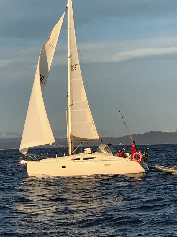
Oskar is an Elan Impression 344; a 35' sloop-rigged yacht that sleeps 5 people comfortably. It's a surprisingly quick and comfortable motor-sailing vessel, particularly if the sails are carefully managed as winds increase in strength. We were to be a crew of 5 for the first week, after which we would lose two and gain one for the remainder of the trip.
The plan was to sail from Hobart north to Deal Island in the middle of the eastern end of Bass Strait. Whether we would get there would turn, as it always does on sailing trips, on the winds being favourable. Happily, the forecast looked excellent for our purposes.
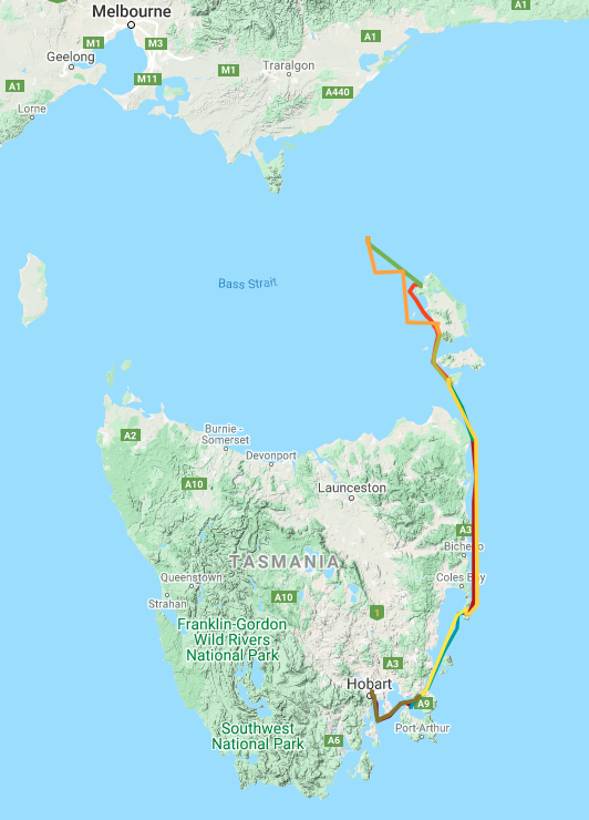
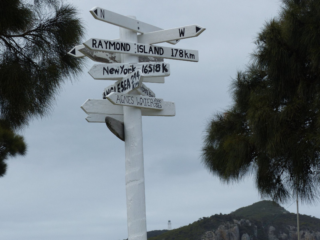
Missing days on the map meant we didn't sail anywhere
Day 1
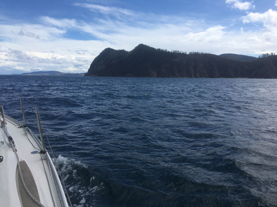
We left on a making westerly breeze which saw us heading close hauled down the Derwent River. At the estuary we turned left and had a quick run across the northern end of Storm Bay in around 30 knots of breeze. We sailed past the ominous looking Blackjack Rock on which, in 1994, the Managing Director of Incat Ferries, Bob Clifford, parked Condor 11, a 78 metre wave piercing catamaran built for Condor Ferries in the UK, during sea trials at night. The vessel was travelling at around 36 knots at the time. It took around a month to get off by the time the hull was patched and salvage experts solved problems caused by the extraordinary friction between the aluminium hull and the rock.
The ominous looking Blackjack Rock

Condor 11 on Blackjack Rock. Courtesy The Examiner newspaper.
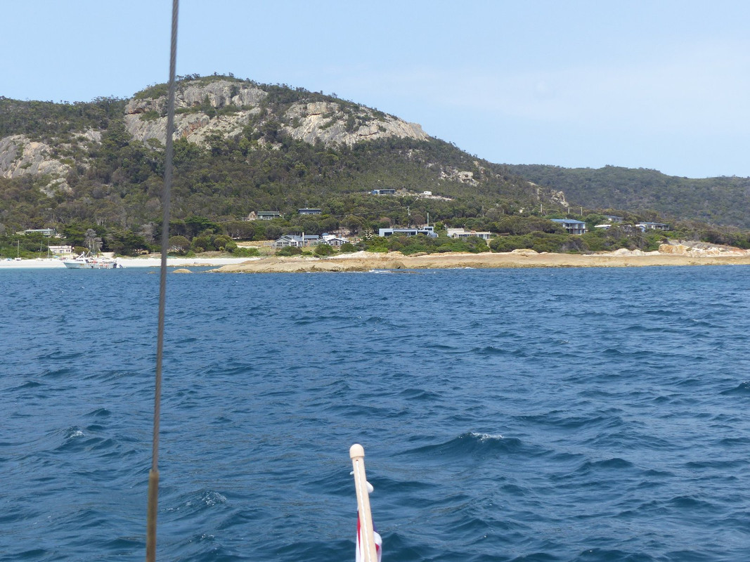
We dropped anchor in the pretty Monk Bay, perfectly positioned for a trip through the Denison Canal at Dunalley the following morning. The skipper immediately set the catering bar high. Luckily it's a task he enjoys and he maintained the standard for the duration of the cruise—no mean feat when there's no freezer and cold storage is limited.
Day 2
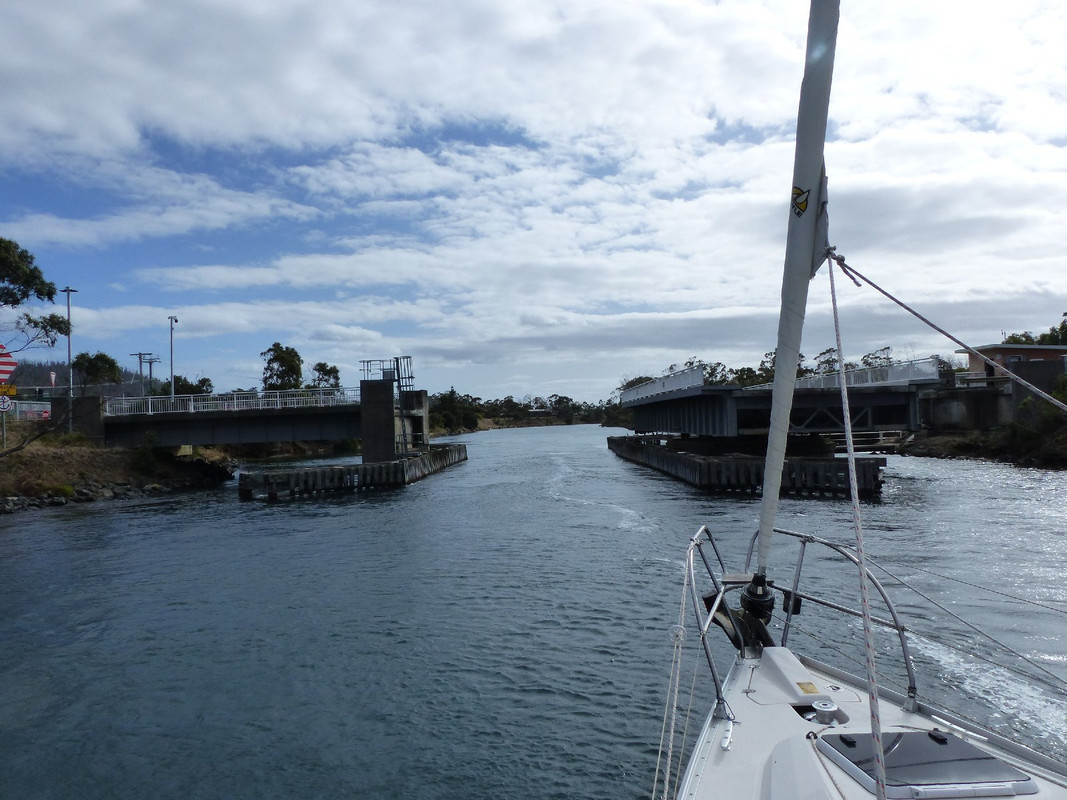
In the morning we set sail for the canal to save us a couple of days' sailing around the Tasman Peninsula. To the extent that the peninsula's coastline is stunning, that was a pity, but the skipper's plan to get to Deal Island didn't leave us enough time to cover the extra miles.
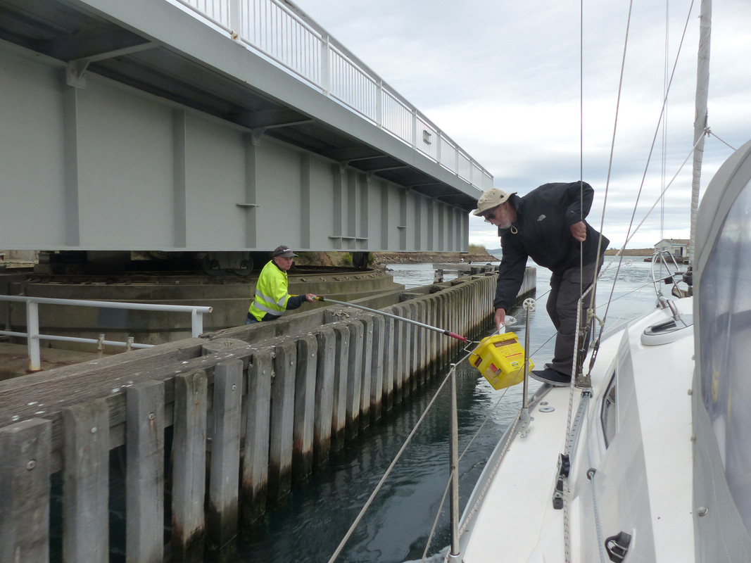
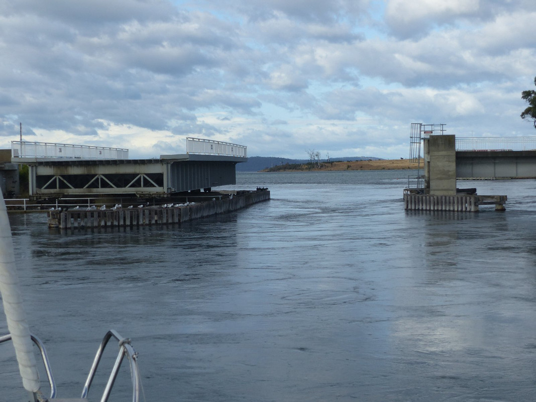
In any event the canal is good fun. Not only do you have to go through on a high tide, you have to time your passage carefully so the current is running in the right direction. Trying to get through the canal on a vessel capable of only 6 or 7 knots under power can be tricky if the current is running at 5 knots in the other direction.
Passage through the canal also requires a bridge to be opened. You ring the bridge operator beforehand and he gives advice on the best time. You then call him up on the VHF radio when you're approaching. He opens the bridge, cutting off the only road access to the Tasman Peninsula, and you steam through. In the old days, he used to hold out a bucket on the end of a stick and you'd pay the fee of $10 and toss in a couple of cans of beer. Modern anti-corruption rules have put an end to this tradition. The vessel's owner is charged by remote control. The hapless crew is spared the frightening task of getting the cans and the money into the bucket as the boat hurtles through the canal at its own maximum speed plus the speed of the current.
Feeding the beast on a previous voyage
The green lights are on and we are clear to go through the canal
The Denison Canal bridge
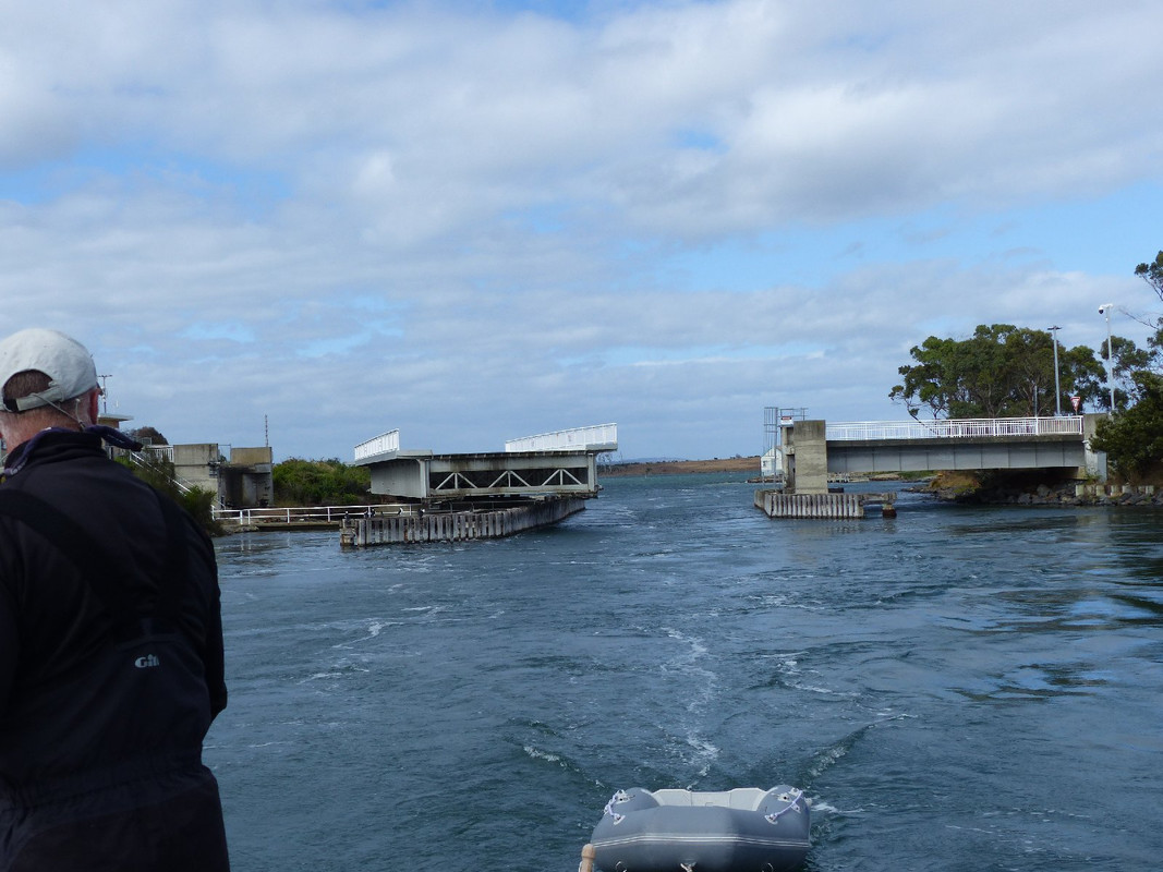
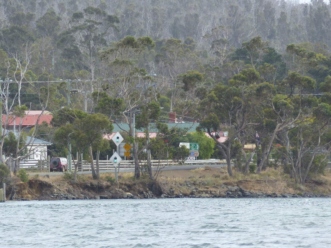
You're not long through before it starts closing
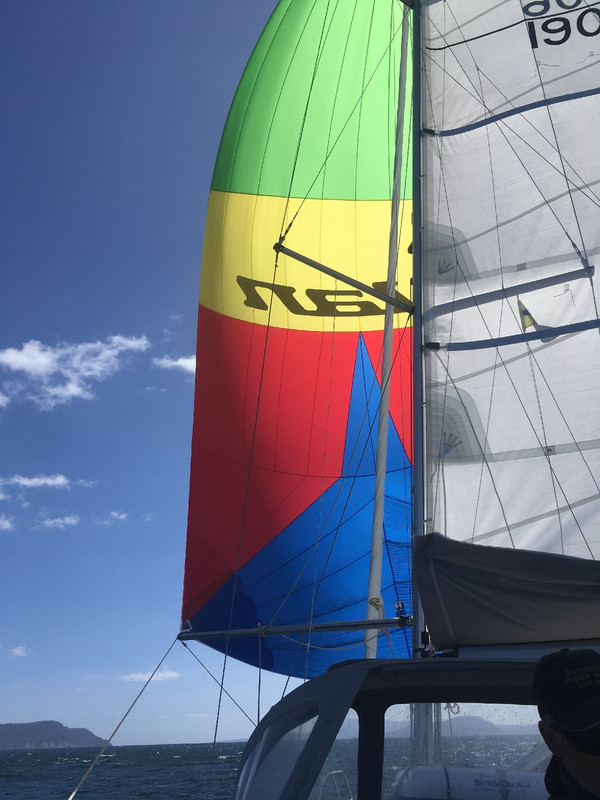
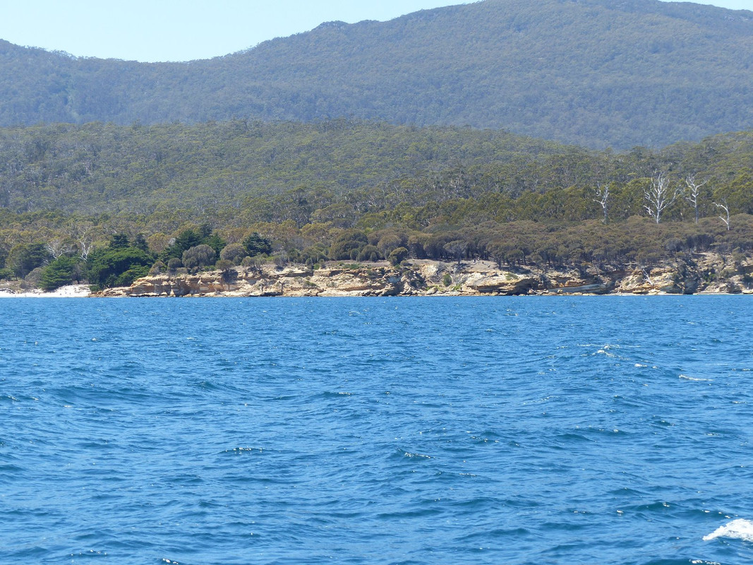
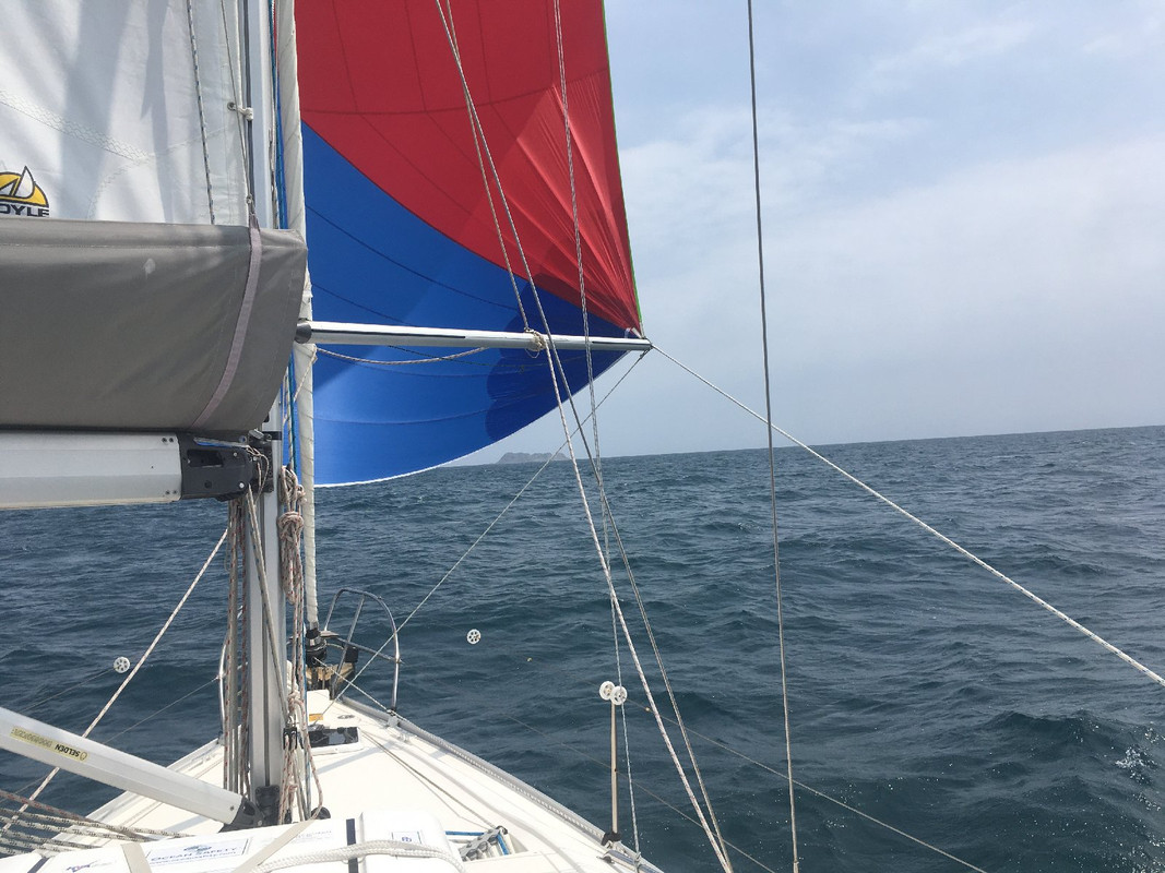
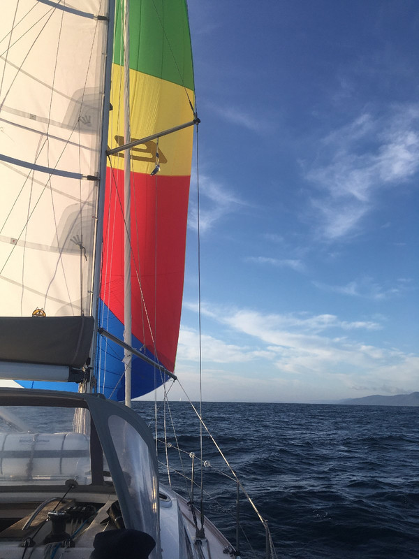
Once through the narrow part of the canal you motor sail through Blackman Bay and out the Marion Narrows to the north. We passed through the narrows with a delightful breeze behind us and hoisted the spinnaker which we were able to carry until the tip of Maria Island. For non-sailors, the spinnaker is a large sail that helps the boat go faster when the wind is blowing from behind. It requires work, but a long spinnaker run while cruising is very satisfying.
Under spinnaker with the Tasmanian mainland to the left and Maria Island to the right
Maria Island is beautiful. A mountain known as the Bishop and Clerk towers over the northern part of the island and the shore sports a number of beautiful white-sand beaches. The water is wonderfully clear but also very cold. Maria Island had a period as a penal colony in the nineteenth century and was also home to a cement plant and some winegrowing. It is now a national park and its northern waters are a marine reserve.
The painted cliffs, northern Maria Island
A wonderful white rock at the northern tip of Maria Island
Mt Bishop and Clerk
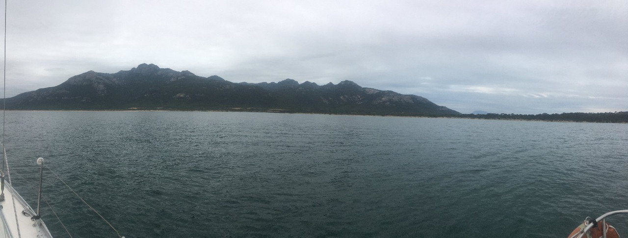
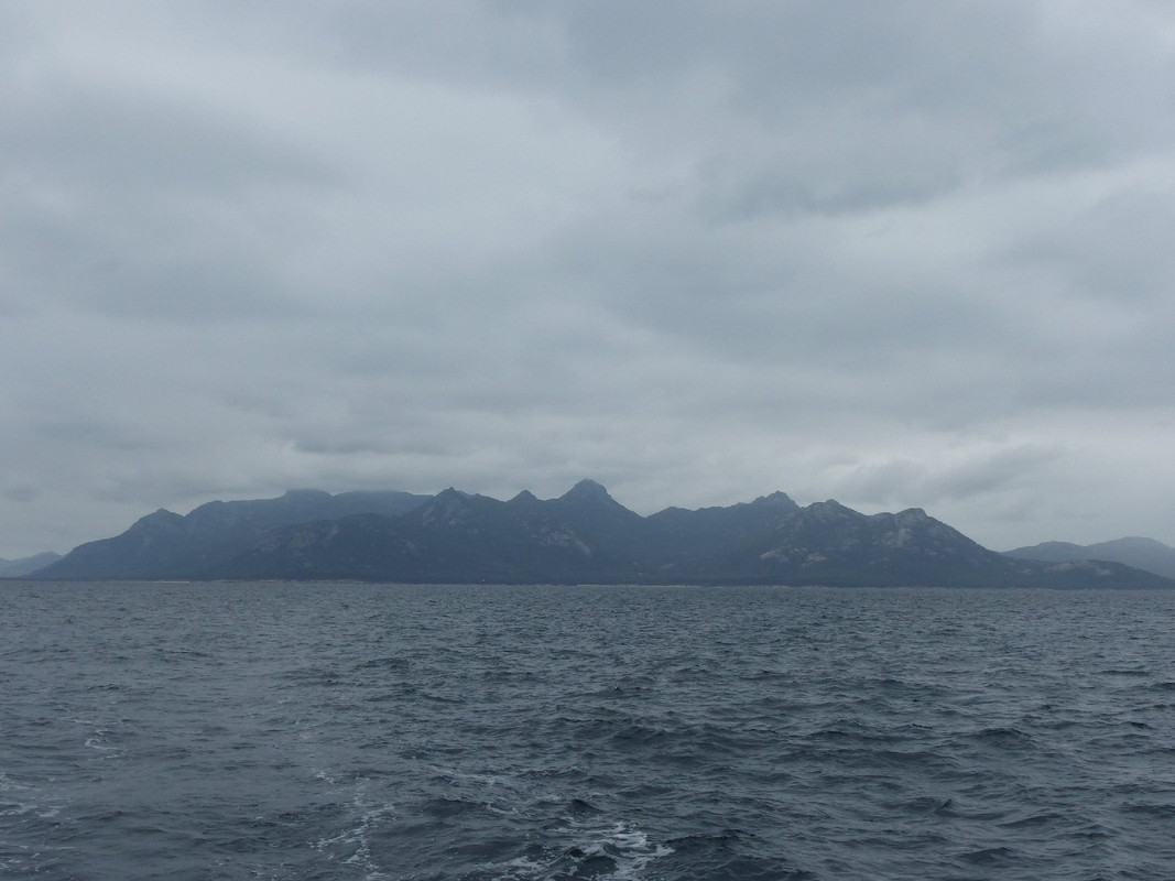
As we reached the northern end of Maria Island the breeze moved into the north east and we had to drop the spinnaker. Luckily the wind remained sufficiently on our beam to allow us a fast sail to Bryans Corner on the southern tip of the Freycinet Peninsula where we would spend the next two nights.
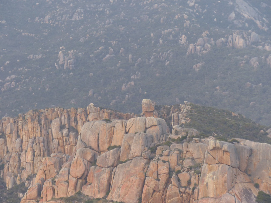
Bryans Corner also sports a beautiful white sand beach which is because they are common on Tasmania's east coast. It's dominated by solid granite hills that tower over the southern end of the bay. Across the Schouten Passage, the northern end of Schouten Island provides shelter when winds are in the south.
Day 4
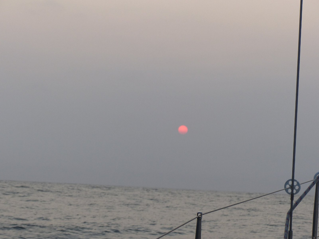
We were up early for what would be the longest leg of our north bound sail. It's nearly 80 nautical miles to Eddystone Point (or around 13 hours sail for the Oskar) where we planned to spend a night before making the run into Bass Strait. It was a hazy day with a combination of sea mist and smoke from the mainland bushfires giving the sun, on the rare occasions that we saw it, an eerie red glow. The south easterly wind promised for the morning by the weather service failed to appear and we motored, often with the sail flapping desultorily. My personal highlight of the day was when the propeller was fouled by a clump of weed which I took a swim to remove. The water was very cold indeed, but by the time I was done I felt cleaner and greatly refreshed.
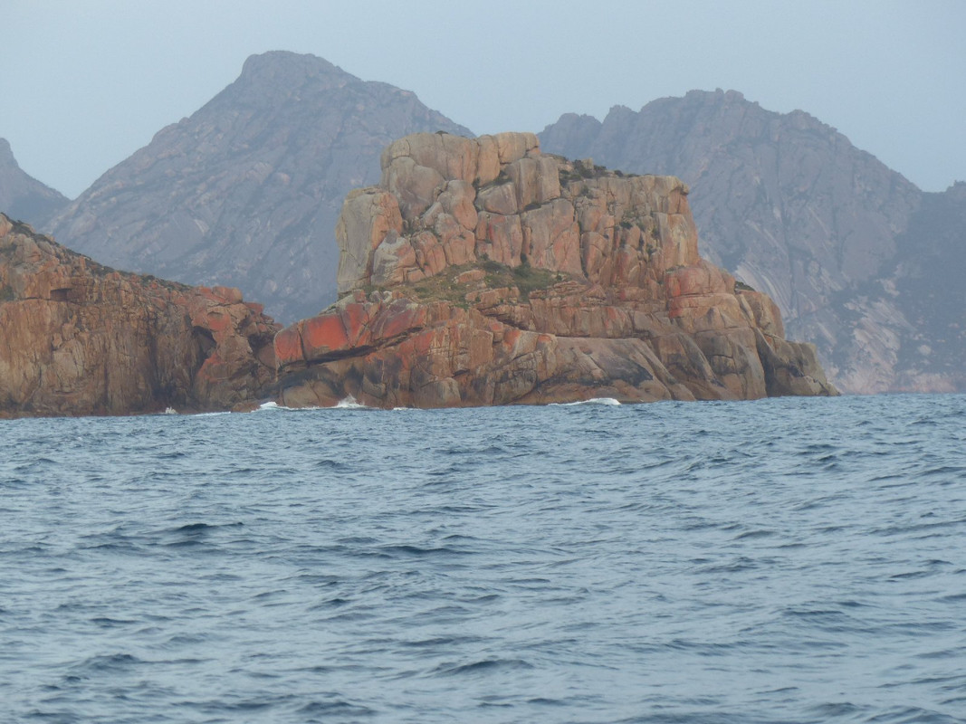
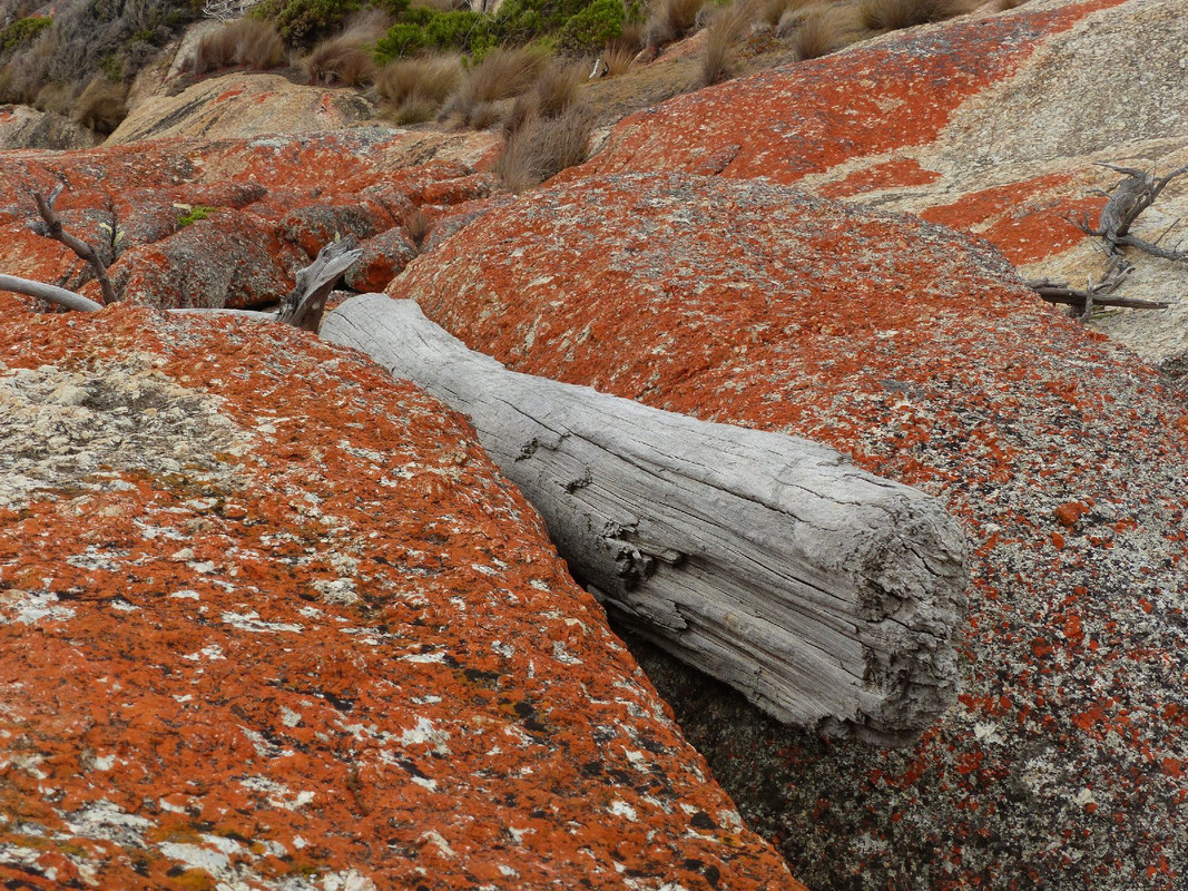
The beautiful east coast granite rocks are coloured by an orange lichen. These ones are at the southern entrance to Wineglass Bay.
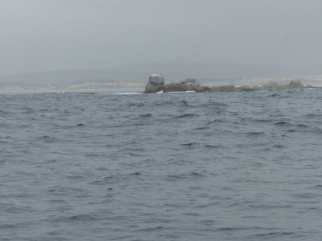
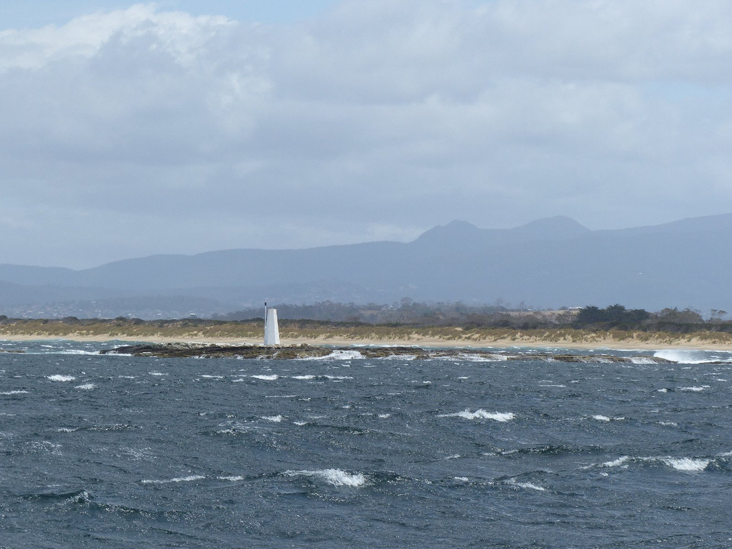
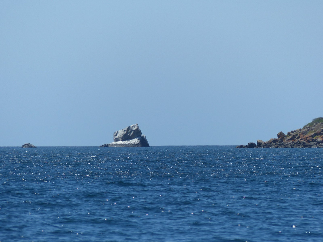
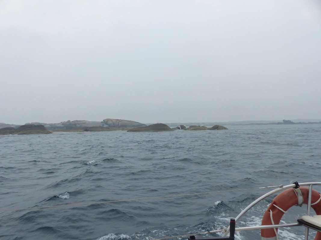
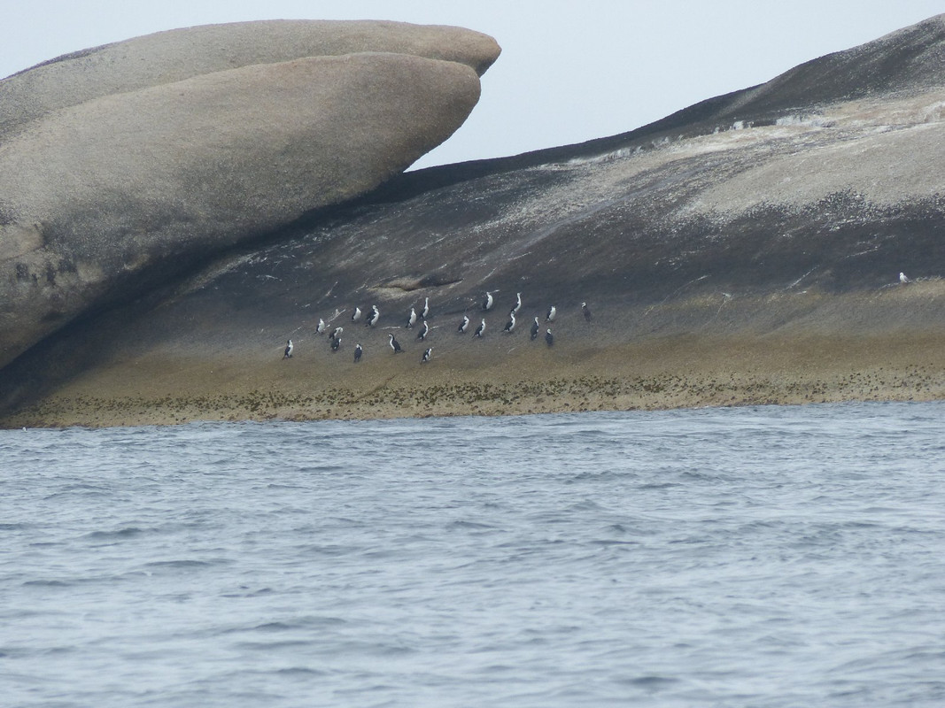
St Helens Island is not something you'd want to run into at night. If you can be bothered following the link to the photo, there's a couple of birds — probably cormorants — to be seen sitting on the island. The spot high and to the right is an albatross.
The anchorage to the south of Eddystone Point is small and requires anchoring behind a reef. It is only possible to anchor there in relatively light breezes that are in the north or north east. We were in luck and, in spite of some misgivings about the quality of the anchorage, were pleased to drop the anchor and have a break.
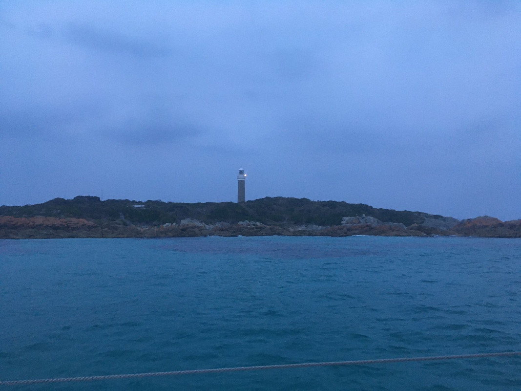
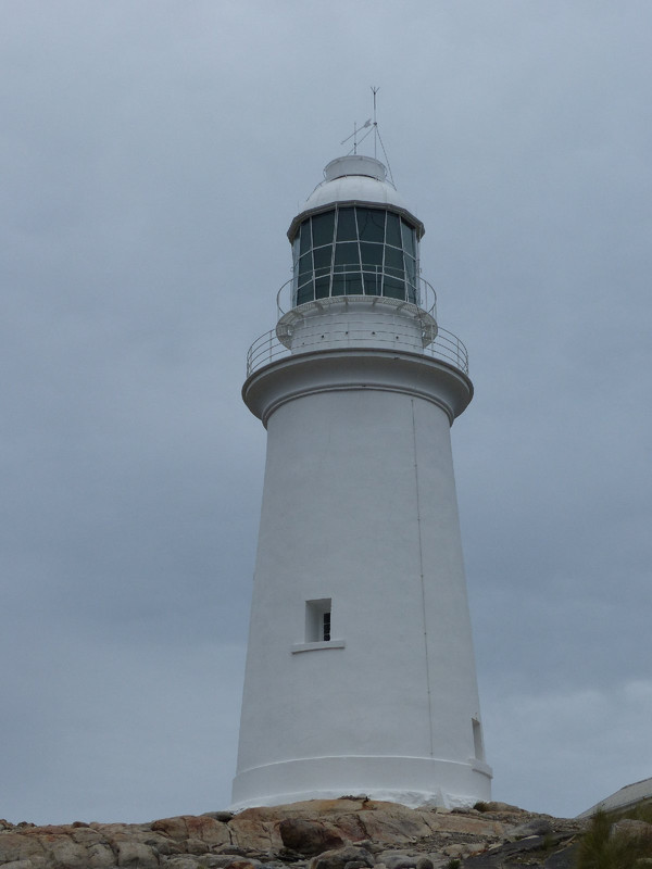
The lighthouse dominates Eddystone Point, although the original light has been replaced by the one you can see
Day 5
It was good to get under way early the next morning. Anchoring in small, open anchorages close to reefs is unnerving and most of the crew had been awake on and off all night making sure the anchor was holding and we were safe. It was another overcast hazy day but there was more wind to help us along.
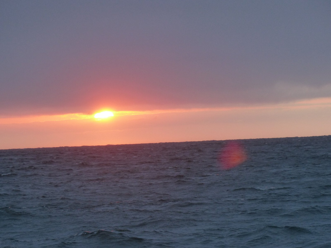
Smoke affected sunrise as we left Eddystone Point
One of the rocks just offshore from the Eddystone light behind which we anchored the previous night
Like the Denison Canal, Bass Strait is subject to fast-running tides and, when negotiating the entry through Banks Strait (between Cape Barren Island and the mainland of Tasmania) it's prudent to run in or out with the tide. The skipper timed our arrival perfectly and we enjoyed a good sail to Clarke Island where we dropped anchor in the very beautiful Spike Bay.
Oskar at anchor in Spike Bay
Not long after we arrived the wind quickly strengthened. It was good to be out of it.
Spike Bay boasts some beautiful rock formations with some monoliths vaguely reminiscent of the Easter Island statues. We went ashore and took an afternoon walk to check them out.
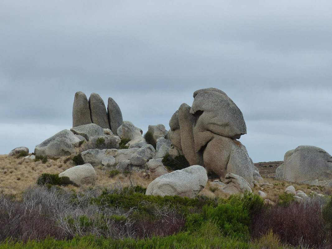
Rock formations on Clarke Island
Looking west into Bass Strait from Spike Bay
Lichen covered granite
Day 6
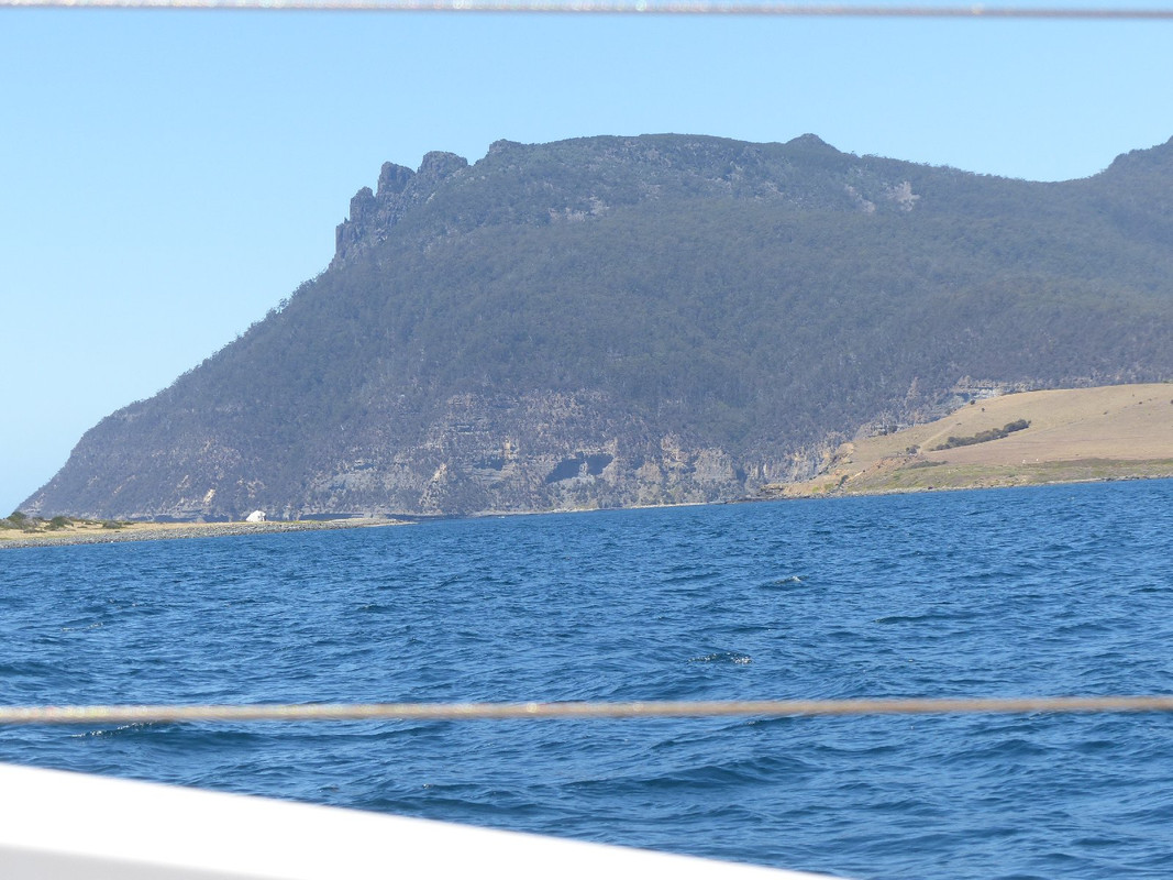
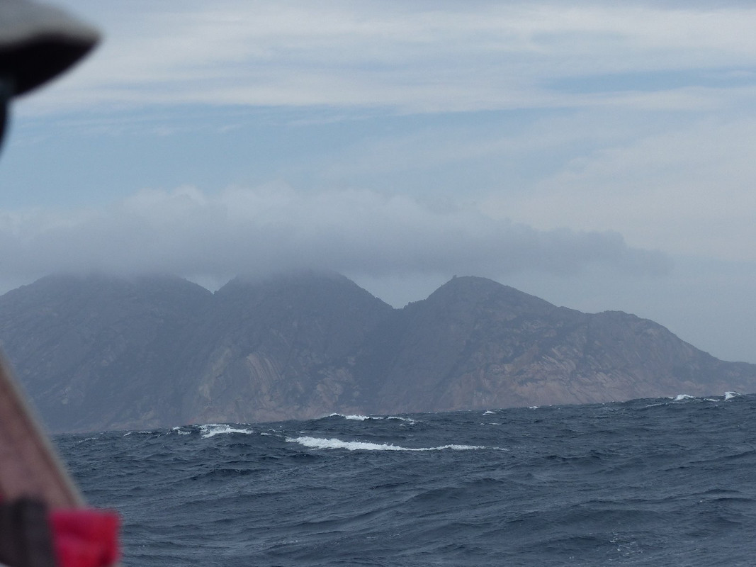
Greeted by another overcast day, we set sail north. While very pretty and interesting, the route past Lady Barren Island and along the west coast of Flinders Island is treacherous. Reefs, rocks, islands and islets abound and there is plenty of shallow water to avoid. We were hoping for a sight of the Strzelecki Range on the south western corner of Flinders Island, but it remained stubbornly shrouded in cloud.
Our plan was to spend the coming night at Killiecrankie at the north of Flinders Island, but we weren't sure whether we'd make it and had a range of contingencies planned.
Killiecrankie gives its name to Killiecrankie diamonds. They're not really diamonds; rather, a kind of topaz and the ones found on Flinders Island are clear, ice blue and pink gold. I don't think I've ever seen one; nor would I have a chance this time as our brief stay meant there'd be no fossicking. Killiecrankie also has a reasonable, if shallow, harbour that provides good shelter from easterly winds and, if you could get close enough to the southern shore, winds through south to the west.
By the time we arrived it was late in the day and blowing quite hard. We were pleased there was a local who was prepared to rent us one of his moorings in the bay. For a travelling yachtsman a mooring is a treat as you simply don't have to worry about your anchor pulling out of the bottom. It makes for a good night's sleep, particularly when there's a reef behind you and not much water elsewhere.
The skipper had arranged the rental earlier in the day. As we sailed into the bay we received a call on the VHF radio from a bloke who kindly guided us to the mooring we were to use. Like motorcyclists, seafarers are mostly kind and helpful to one another.
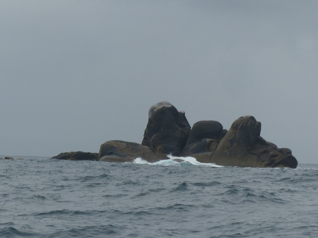
An assortment of rocks off the west coast of Flinders Island
Day 7
The day dawned sunny and early on we were visited by two blokes in a motor boat who came to collect the $20 charge for the use of the mooring. One was the bloke who had guided us in the night before. They were cheerful and gave us some advice about what to do and see at Deal Island.
So, in a freshening easterly breeze we set off, heading just north of west in search of Deal Island.
Leaving Killiecrankie
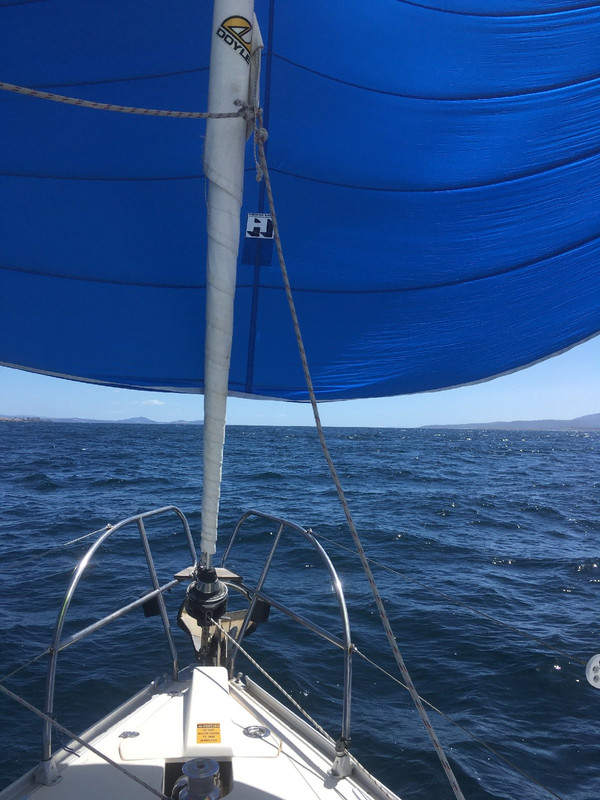
For about half the 34 nautical mile trip we carried the spinnaker, travelling quickly into Bass Strait past Craggy Island. Not the home of Father Ted; a different Craggy Island, in another hemisphere. The skipper had brought along episodes of Father Ted on DVD for us to watch, presumably as part of a team building program.
Craggy Island in view under the spinnaker
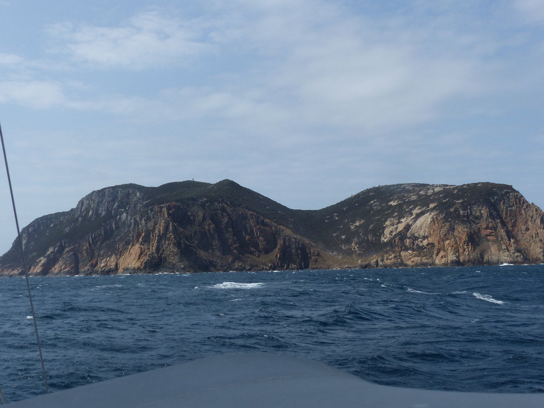
When the wind strength reached 20 knots and carrying the spinnaker became uncomfortable, we dropped it and continued what was a fabulous sail into the southern end of the Murray Pass between Deal Island to the east and Dover and Erith Islands to the west.
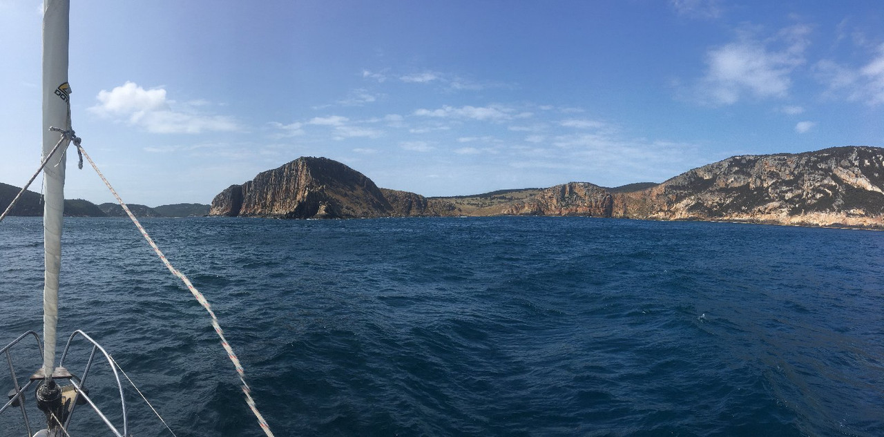
Deal Island is on the right; Dover and Erith to the left with Murray Pass between
According to the navigation guide, Murray Pass can be treacherous in difficult conditions. The tide runs through it very quickly and, when the wind is in the opposite direction, can generate standing waves of 5-6 metres in height. Standing waves can result from a clash of wind and tide or tide and currents and are basically waves with crests that are not moving in any direction. Read all about the physics right here in Wikipedia.
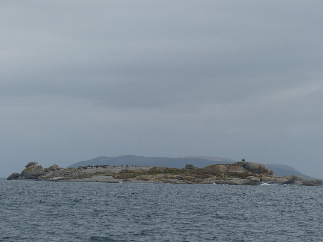
The south coast of Deal Island. The tip of the lighthouse can be seen on the top of the left-hand hill
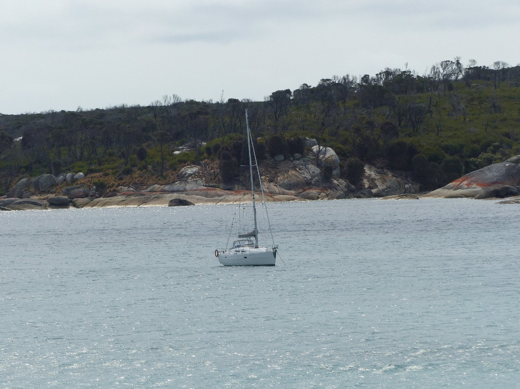
Fortunately for us, there was no such excitement and we anchored next to a Beneteau 42 in the very pretty East Cove at the foot of a steep hill. Why it's called East Cove when it's on the western side of the island, I have no idea, but it's very pretty indeed. It turned out the Beneteau was owned by a Victorian-based couple who, with their mate, were on a cruise to Tasmania.
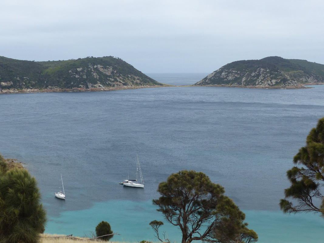
East Cove. Oskar on the left. In the background, Erith (right) and Dover Islands. At low tide they appear joined.
Day 8
Deal Island is home to the highest lighthouse in the southern hemisphere, standing 1,001 feet above sea level. It was deactivated in 2002. I couldn't figure that out as the chance of seeing a tall light house from a long way away seems to me to be better than the chance of seeing a lower one. According to Wikipedia, however, the height caused visibility problems in low cloud conditions. As Bass Strait is not a body of water to be trifled with, this may well have been a legitimate concern.
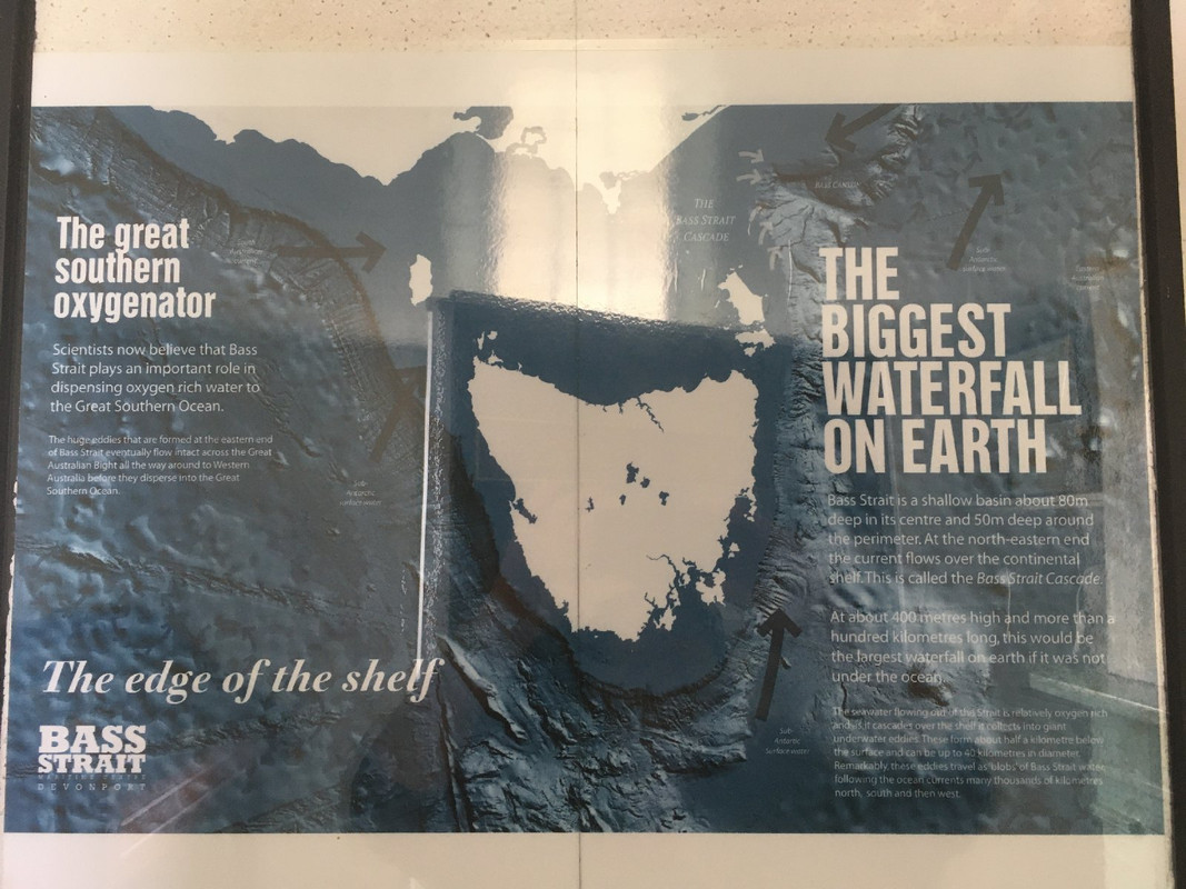
I've included the picture above for science nerds. In order to read it, you may well need to follow the link to view the picture in a higher resolution. If you can't read it and are interested let me know and I'll reproduce the text.
The island is stunning: a large pile of granite sticking pretty much straight out of the water. It's a national park and there's a small but interesting museum in an old house on the way up to the lighthouse. Volunteer caretakers live there on a rotation and care for the grounds and a small house that is available for rent. Of course, you have to pay for the flight or voyage there and take all your own supplies. But, if you like wild and scenic places, it would be a great trip.
We made our way ashore to climb the 1,000 feet to the lighthouse. The first part of the walk was a steep climb up the hill to the houses. There were spectacular views to Dover and Erith Islands and the bay where the boats lay at anchor. Fearless wallabies (kangaroo-like creatures), of which there are many on the island, watched us climb. We checked out the museum and said g'day to the volunteer caretaker before setting out for the lighthouse. The first part of the walk gave us a view over the south-eastern part of the island and the Murray Pass, but we soon passed into the largest sheoak forest I've encountered and made our way up the hill through what felt a bit like an airy tunnel. It was a gentle walk at first but the gradient got steeper as we neared the summit.
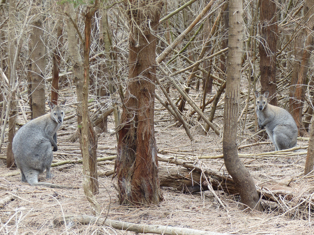
Wallabies in the sheoak forest. There's plenty of them on the island and they're very tame
Signpost near the museum with the lighthouse in the background
Deal Island lighthouse
We had a bit of a poke around and then, as there was no mobile signal in East Cove, spent time on our phones getting email and sending messages. After the obligatory photos we made our way down the hill for a late lunch and a rest. We joined the crew of the Beneteau for pre-dinner drinks and canapes before adjourning to Oskar for a splendid roast prepared by the skipper.
Day 9
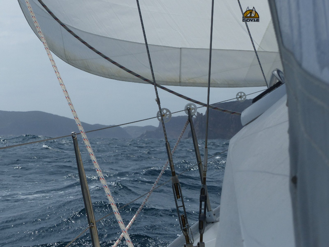
We were committed to be at Whitemark on Flinders Island by the end of the day to deposit two of the crew ashore and collect another who, amongst other things, was bringing fresh fruit and vegetables. The forecast was not wonderful, so we were up early and under way, from the outset beating directly into the wind. We had what turned out to be around 11 hours sailing ahead of us.
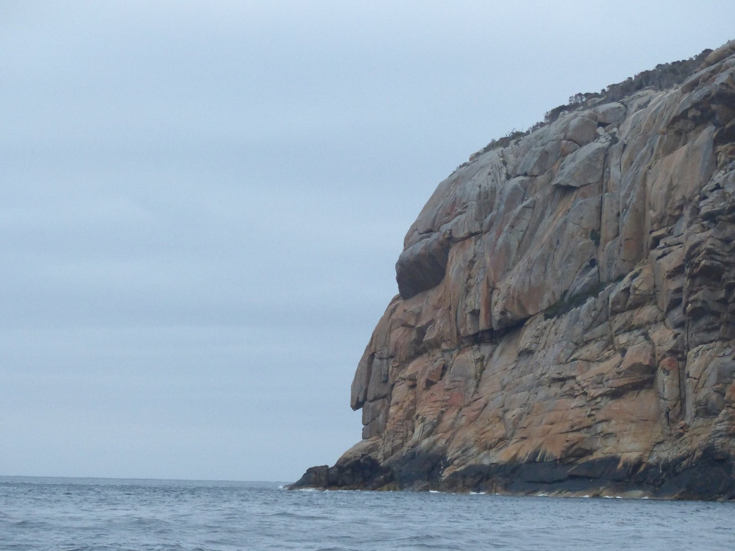
We enjoyed the profile in the cliff at the entrance to East Cove
It was really the only time on the voyage that we spent an entire day beating into the wind. There was a good, strong breeze and the boat sailed fast and well, but the need to tack into the wind meant the length of the journey was increased and we were not as comfortable as we would have been with the wind behind or across us.
Nonetheless, we arrived in good time and, as planned, on the high tide which meant there was enough water for us to get alongside the jetty and transfer crew and gear and make our way out of the bay. We weren't ever completely sure we wouldn't run aground in the process as the approach to Whitemark is very shallow indeed.
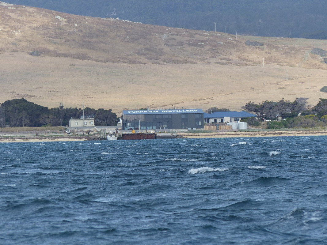
Approaching Whitemark jetty. You can see the huge distillery and there's a pub somewhere behind it. We didn't see a great deal else.
With the new crew aboard and back in deeper water, we made our way a short distance south to Trousers Point where we would spend the next two nights.
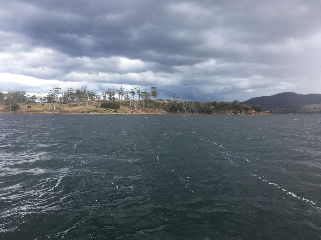
As we motored in, to rejoin our friends aboard the Beneteau, low cloud meant there was still no sign of the Strzelecki Range that towers over the bay. As we discovered, the navigation guide was on the money when it reported that the range affects the local wind, blasting strong squalls across the bay.
Day 10
I have little recollection of what we did all day. It rained from time to time and the wind blew hard from the east and we were glad to be out of it, although it may not have been quite so bad away from the effect of the range. Our friends on the Beneteau were anchored near us, but it was too windy at drinks time to make it possible to return their hospitality.
The other crew members assured me the Strzelecki Range existed, but there was no sign of it all day.
Day 11
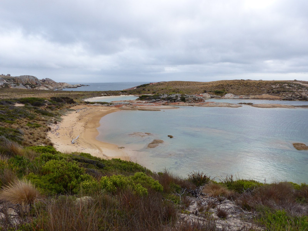
The morning dawned cloudy but clear and there was Strzelecki towering over us. Our plan was to return to Clarke Island for the night and then head south the following morning. Thinking it would be interesting to try to stay somewhere else we bypassed Spiky Cove and headed into Rebecca Bay. A long south-easterly swell rolling into the bay meant that, even though we were sheltered from the wind, we would spend an uncomfortable night. So we turned around and returned to Spiky Cove. The others went ashore for a walk and I set to with a couple of fishing lines to see whether I could augment dinner. I'm no fisherman, but I've never gone quite that long without so much as a nibble. We had to make do with ship's rations.
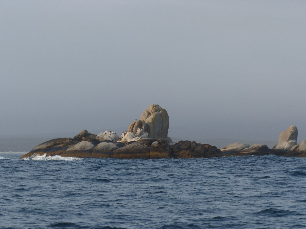
A rock sentinel in a big hat
I still can't decide whether these were penguins or cormorants. I still prefer the idea that they're penguins.
There was a striking sunset across Bass Strait. Photos, of course, fail to do it justice.
At around 9.00 pm, as we finished the washing up, it became clear we were going to have an uncomfortable night in Spiky Cove. The wind had moved into the west and, although not blowing terribly hard, was causing the boat to lie across the swell and roll around. The tide was or would soon be running out of Bass Strait, so we hauled up the anchor and set sail south. We would sail through the night as there was nowhere in easy reach that would provide a reasonable anchorage.
It's quite an agreeable experience sailing at night in pleasant conditions. There was patchy cloud and, occasionally it cleared so we had a magnificent view of the stars. At the wheel it was hard to see much ahead as the light from the instruments was strong, but two of us were always on deck, one steering, one watching. Oskar has a plotter—a GPS linked device that shows the boat's position in real time on a maritime chart. It makes sailing at night and in unfamiliar waters much less stressful than in days of yore when you had to work with a paper chart and a compass. Being blinded by the thing was not such a problem as it might have been.
You also come to realise just how important lighthouses are to seafarers as you confirm your course by constant reference to them.
Day 12
We'd done 2-hour watches. I finished my second at 0500 and went straight to sleep. I was rudely awakened around 0700 when a passing boat called on the VHF radio asking for the skipper's telephone number. He had taken photos of us sailing in the early morning light and wanted to send them to us.
My watch mate leapt up and immediately dragged the spinnaker on deck. We hoisted it for what proved to be a long and agreeable run down the north-east coast of Tasmania. As with the trip across to Deal Island, we were thwarted by the breeze getting stronger and eventually we dropped it. Later, with a couple of reefs in the mainsail and the wind largely behind us we dropped the jib as well. We still enjoyed a fast and exciting sail, even setting a new speed record for the boat as we surfed down a wave.
We soon had the spinnaker up. The sail of the yacht whose skipper took the earlier photo can be seen in the distance.
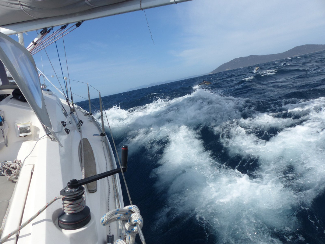
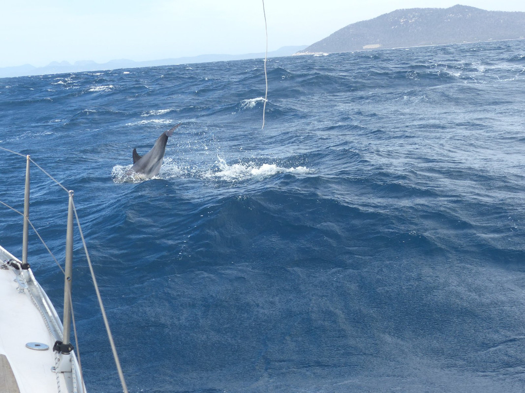
Almost every day we saw dolphins and myriad sea birds, including albatross, a truly magnificent bird. We saw the occasional seal, including one day when we mistook a distant colony (or harem) of seals for dolphin as they leaped from the water in an energetic pursuit of a school of fish.
This day, we were chased by dolphins for quite a way. Trying to photograph them is usually a futile endeavour, but this day I lucked out a couple of times. You'll have to follow the link to the first photo and then zoom in to the right of the boat to see them.
After about 18 hours sail we again dropped anchor in Bryans Corner at around 3 pm.
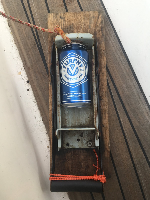
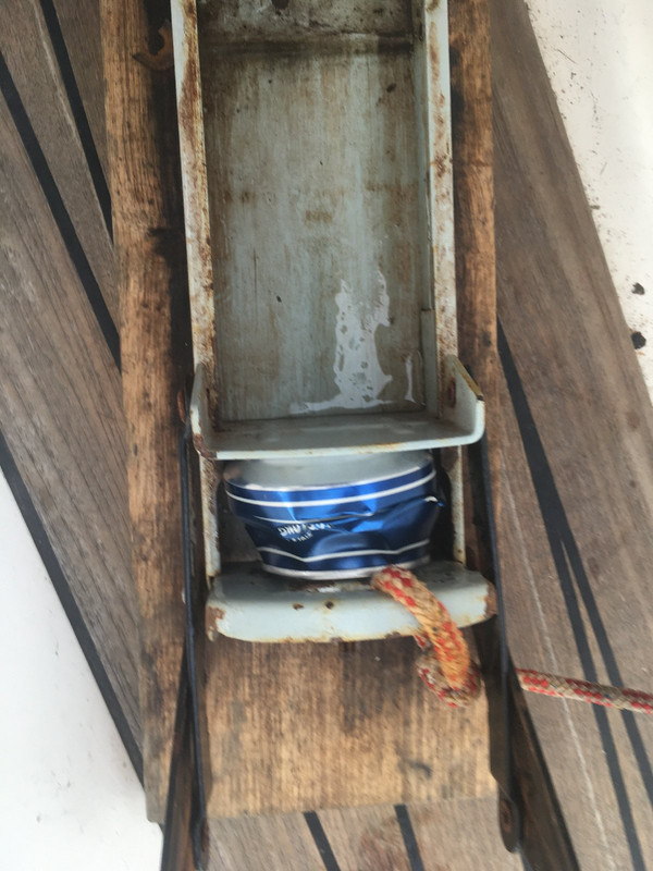
When it's necessary to park a motorcycle on wet ground, a convenient way to brace the side stand is to down a can of beer or other beverage, stand it upright on the ground and then stamp straight down hard. The stand can then be rested on it, decreasing the likelihood that the bike will sink gracefully into the mud. This useful contraption produces a more consistent result, saves damaging the deck of the boat and greatly reduces the volume required for the storage of rubbish.
Day 13
The plan was to have a relatively easy day and spend a night in Chinamans Bay on Maria Island. We set off with little breeze in overcast conditions and occasional showers. The weather improved and the wind strength increased until it was perfect to hoist the spinnaker again. We enjoyed another long run before we had to take it down.
As the day went on and the forecast for the rest of the day and the next evolved, we decided not to stop at Chinamans but to push on through the Marion Narrows and into the approaches to the Denison Canal. There is a public mooring there and we would be well positioned to catch the tide around 0800 the following morning.
As we arrived to pick up the mooring, we were struck by a sudden squall producing blasts of wind, rain and even hail. It lasted long enough to make grabbing the mooring entertaining and give us all a good soaking. As quickly as it arrived it was gone and we settled to what would be our last night on the boat.
For a while I couldn't remember why I hadn't taken many photographs. I recall that my camera got wet when I left it where the rain could get at it and it stopped working. Over the next day it had dried out and recovered. I took a couple of photos from the phone.
Hellfire Bluff on the Tasmanian coast at the southern end of Maria Island. The Marion Narrows — the northern entrance to the Denison Canal — is at the left edge of the photo.
Through the Marion Narrows and steaming toward our mooring. The black cloud over the point ahead was the source of the soaking we collected.
Day 14
The forecast was for winds in the west to north west which was not particularly helpful. We motored through the canal as early as the operator would let us and with the tide still running slightly against us. Once into Frederick Henry Bay we hoisted sail and made our way close-hauled towards Sloping Island.
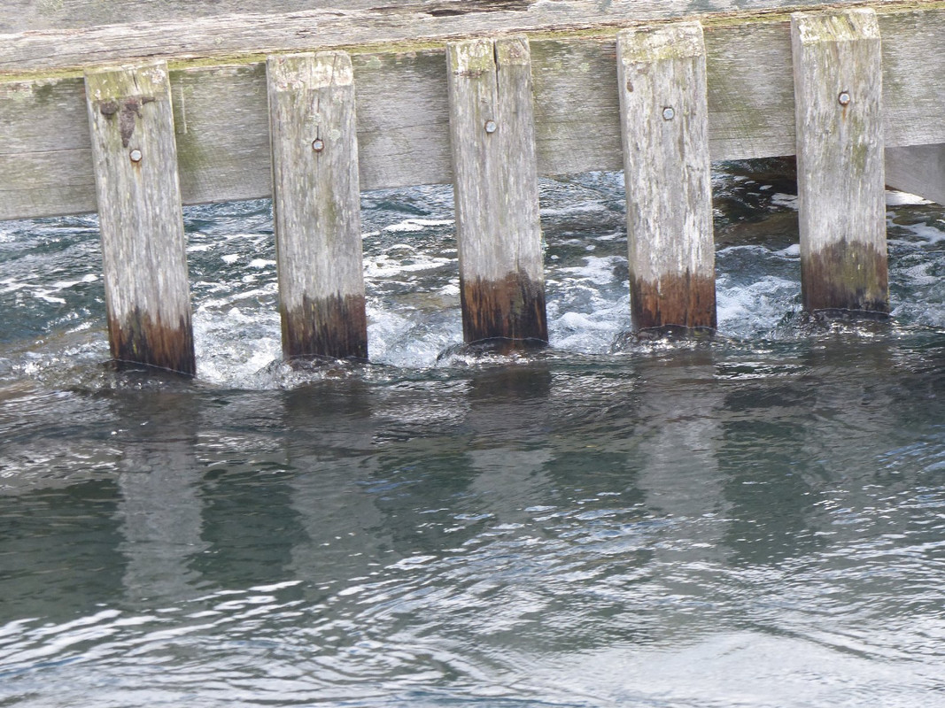
Tide racing against the jetty on the way through the Denison Canal. We were pushing against that this time.
Often when the wind is in the west in Hobart, it fluctuates in strength and direction and today was no exception. The breeze ranged from 5 – 30 knots. Nevertheless we enjoyed the sail and were soon into the Derwent River for the final leg home.
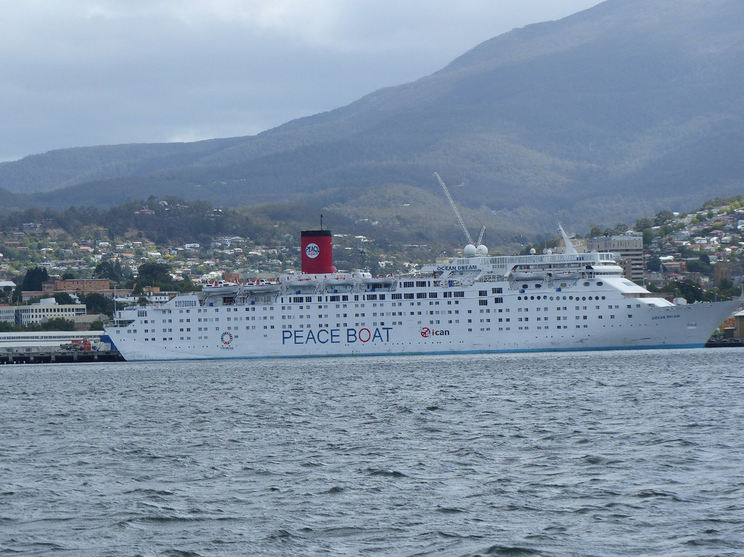
There was a cruise ship tied up in the harbour in Hobart. It was called both the Peace Boat and the Ocean Dream. It was a cruise ship that is now run by a Japanese NGO.
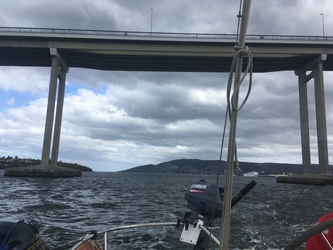
I threw in this final picture partly because it's taken looking south down the Derwent River in the general direction of Antarctica. More importantly, it shows the span of the Tasman Bridge that was knocked out by a cargo vessel, the Lake Illawarra, on a dark, wet Sunday night in January 1975. The concrete span fell 45 metres, landed on the ship and sank it, killing seven crew members. Five drivers and passengers in cars were also killed when they drove off the edge of the bridge. The occupants of these two cars were amazingly lucky.


The Lake Illawarra still lies on the bottom of the river resting against one of the bridge's pylons. It's inspected regularly.
The span was repaired over the course of a couple of years and an additional lane added to the bridge, but the perfect symmetry of its pylons was lost. Interestingly, the damage to the bridge provided a significant business opportunity to a ferry operator called Bob Clifford who, within hours, mobilized ferries he was trying to make a profitable business from. They became profitable, at least for a time, and Clifford went on to build wave piercing catamarans, one of which he parked on Blackjack Rock (see day 1 of this voyage).
There's more information in Wikipedia and a human interest story here.
We arrived at the marina around 3.30 pm, did a quick rubbish removal and tidy of the boat (there'd be another round of that the next morning) and headed for home. I installed a new clutch lever and went in search of my wife, a shower and some clean clothes.